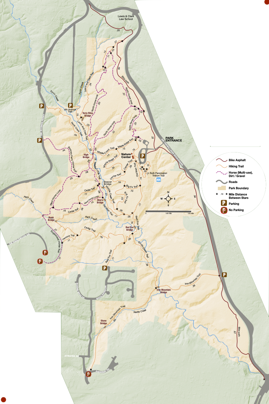
We describe steps we followed to overlay a trail map over the street maps we used to reach trails. See Marshall Proposed Trail System
Tryon Creek OVERLAY http://trails.ward.asia.wiki.org/assets/pages/tryon-creek-trail-system/tryon_map.png 45.4222946, -122.6900652 45.4538305, -122.6623238 BOUNDARY 45.4234457, -122.6906689 BOUNDARY 45.4510591, -122.6594842